Where at in Lafayette? - Brochure


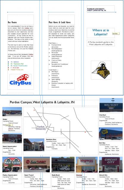
I think for the most part, the data map and brochure is coming along nicely, for the final draft I will be redoing the actual map. Both bus routes and stores will be color coded for easy location. I may take out Furniture Row, not only because it's rather expensive for college students, but for room for a blown-up map of either the mall for an enlargement of stores or downtown for bus routes.
Also, if anyone knows of any good, large, blank maps of Lafayette I could use that would be AWESOME! Google/MapQuest wouldn't work because of all the side streets, I can't use all the clutter, and I'm really looking for a simple black/white. Otherwise I may look into modifying a CityBus map (if that is not a copyright violation/plagiarism/etc)?
Well, from what I can see it looks like you have a good start. There doesn't seem to be anything on the road map corresponding to the bus route. The photos near the road map seem helpful. You might consider connecting the images to their corresponding location on the map. What you are trying to do is interesting, and it looks like you're headed in the right direction.
Submitted by jtirrell on Sat, 09/15/2007 - 17:58.